Day 84 - Friday, August 20
Our day began early in the morning around 2am with the realization that it was freezing inside the RV which meant it was even colder outside - there is no insulation so it is like an icebox - it was raining really hard and the wind was knocking the RV around. I decided to wait until sunrise before heading out into the freezing weather.
I ended up running into a wall of wind and rain for the first few hours until the rain cleared and later in the morning the wind calmed down presenting me with a perfect running day. Lucky was all game for the challenging conditions as he does best in cooler weather. Shortly after the sun came up, he spied an antelope on my left in the distance. I told him “free” as I always saw him approach the barbed wire fence and look out on the prairie without going to the other side. Until today…he blasted under it and took off after the animal. As it ran, it also raised the alarm for the other sleeping on the ground so that a herd popped up and starting running away from the road and towards the mountains. I yelled at Lucky to come back but it was into the wind and I just watched him disappear into the distance. I stopped running and thought this must be the end. Until a few minutes later I could see him in the distance running full on across the desert back to me. I took a video of him coming out.
Today’s route had us leaving Jeffrey City headed towards Farson. The 120 miles in between are remote but full of history along the pioneer trails. The first piece of history on the route was The Ice Slough.
The second was Sweetwater Junction where I met 2 sisters of the Mormon Church who were kind enough to give me some history on the area.
The third was cresting the pass at roughly 7,000’ and descending into another micro climate where the pioneers headed for South Pass and the Continental Divide.
We stopped at the bottom of one of the descents for the day around 4pm and drove ahead 17 miles to Twin Pines RV Park for the night. Tomorrow we will return to the spot and resume towards South Pass.
All for today after 3,344’ of climbing - thank you for your support.
Cheers,
David.
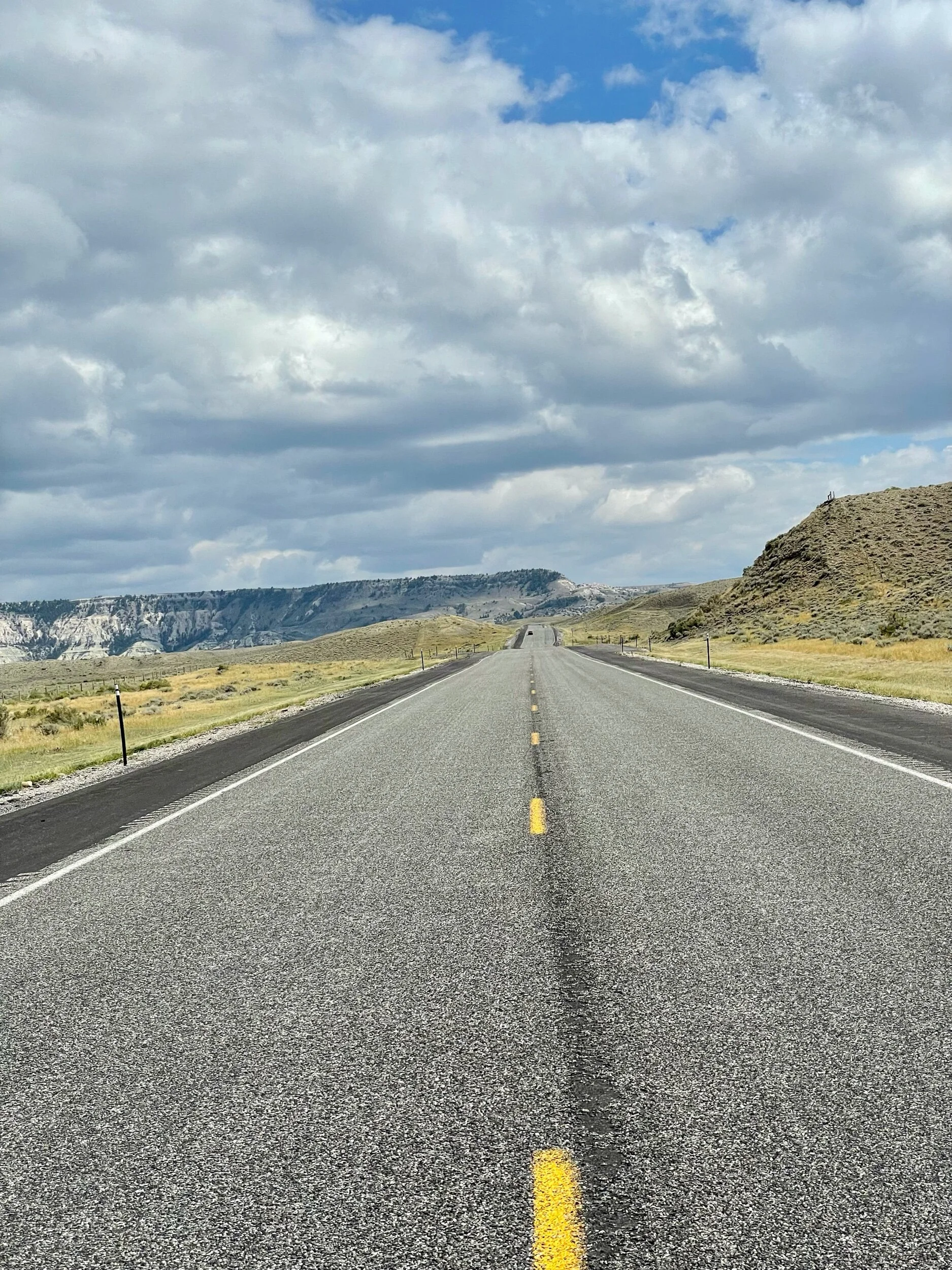
The road to ourselves…
Lucky coming back to me after chasing a herd of Antelope
A nice shoulder for us to run on
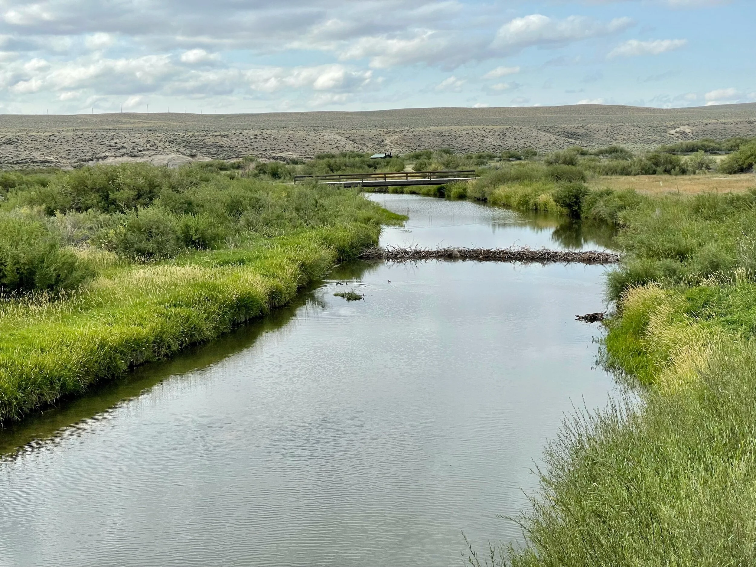
The Ice Slough - As travelers on the Oregon Trail made their way west up the Sweetwater River valley, they found the grade even, but the road was often sandy and the winding river required many crossings.
Thirty miles or so before the trail left the valley to climb steeper stretches toward South Pass, emigrants forded the river yet another time, crossed a sandy, five-mile stretch and then came to a place many seem to have heard about in advance, though some doubted its existence.
This was Ice Slough, better known in the 1840s, 1850s and 1860s as Ice Springs.
”We were told we would come to ice spring this evening,” California-bound Thomas Eastin wrote July 14, 1849. “[W]e were told that we would find it in a low swampy place and that by digging a little below the surface we would find plenty of ice. The story appeared incredible and we paid no attention to it …”
But when Eastin’s party arrived they found other travelers already camped there—and, in fact, one or two were eating ice. “They took us to the place where they got it and with a spade we dug down about 12 inches beneath the surface and there sure enough found as pure ice as I ever saw about 10 inches thick,“ he wrote.
“We took up a bucket full. The story I fear will hardly be believed but it is nevertheless true.”
The Ice Slough is actually a small, subsurface tributary that drains into the Sweetwater. A variety of marsh grasses and related tufted marsh plants, known as sedges, form a patchwork of surface plant life. Water flowing underneath this peat-like vegetation freezes solid in the winter and remains frozen during the spring and early summer, thanks to the insulating peat.
Longtime trails historian Gregory Franzwa called the slough "one of those absolutely delightful interludes that somehow seemed to crop up just as the incessant slogging west was putting emigrants in the lowest of spirits."
Ice Slough in winter, looking south from U.S. Highway 287. Randy Brown. Ice Slough today, where it drains under U.S. Highway 287 and north toward the Sweetwater at the top of the picture. Wyoming Tales and Trails. “Here we found a great curiosity,” Mormon pioneer Norton Jacob wrote June 24, 1847. “[It] would seem that Vegetation & Frost had agreed to operate in copartnership, for in digging through a grassy turf to open a Spring we found plenty of Ice!”
Some travelers were prepared for a treat. “[W]e gathered several buckets full [of ice], Dr. William Thomas noted on June 16, 1849, “from which we have had mint julips in abundance.” Others could only remember past pleasures. “[W]ere it not for the absence of Brandy and mint, we might have had a beautiful Julep,” Henry Mann wrote when he passed Ice Slough two weeks later.
Because the place was such a novelty, many, many diarists wrote about it. In spring and early summer, some described a layer of peaty plant life floating on a layer of heavily alkaline water, under which lay the ice—clear, sweet, thick and good tasting.
“The Ice is found from 8 to 10 inches beneath the surface,” James Pritchard wrote on June 16, 1849. “There is from 4 to 6 inches of water above the Ice, and a turf or sod of grass apparently flo[at]ing on the water, upon which you can walk all over it. You can stand and Shake for 2 or 3 rods Square.” Many emigrants noted this shaking ground as they passed; some seemed to have seen similar shaking in bogs elsewhere.
“The water above the Ice is pretty strongly impregnated with Alkali,” Pritchard continued. “To get to the Ice you take a spade or Ax & cut away the sod & then strike down & cut it out in Square blocks. The Ice is clear & pure entirely free from any Alkali or other unpleasant taste. It is from 4 to 10 inches thick, and as good as any I ever cut from the streams in Kentucky,” he concluded.
As the summer weeks passed, emigrants described a layer between the ice and the peaty plant layer that was more and more like mud and less like clear--if alkaline--water. By late summer, many were unable to find any ice at all.
Steady use of the trail over three decades by what eventually totaled hundreds of thousands of people and millions of head of livestock seems to have changed the place as well.
In early July 1862, Oregon-bound Aaron Clough found a company of around 40 soldiers camped near the slough, and most likely near what had been a Pony Express station the year before until that operation was abandoned on completion of the transcontinental telegraph. The troops were probably members of the Ohio cavalry regiment that had arrived in the area a few weeks earlier to protect white travelers from raids by Indian warriors.
The place seemed less charming to Clough than it had to earlier diarists. “The slough at Ice springs is a spouty, swampy place, and is a dangerous place for stock. You can shake the ground for rods around by jumping up and down. If an ox gets stuck in the slough, it is almost impossible to get him out. … The water has a bad taste, a kind of sulphury or stone coal taste, like the water in the wells down on the Platte.”
Two weeks later, Randall Hewitt found the place littered with the carcasses of dead animals, killed, apparently, by the bad water. Buzzards were preying on the carrion. “It was a dirty, sandy, pestilential hole,” he wrote.
And the Army’s horses and mules had eaten nearly all the grass. “This escort had so far succeeded in just about denuding the country of what little feed there was, and was always sure to locate and occupy the best spots,” Hewitt wrote.
He felt tricked; it made him angry. “This delectable spot is named ‘Ice Spring’ by the guide books,” he noted. “It was said ice could be found by digging down about two feet. All traces of ice, if there had ever been any in the summer season, had disappeared before we got there. That ice story was a cold-blooded romance, put in the guide books to deceive.”
The road to Sweetwater Juncion
Sweetwater River where pioneers crossed the bridge
Road Angels Karim and Darci stopped to see if I needed anything on their way to a bicycle festival.
At the top of the pass - Beaver Rim, the Wind River Mountains, part of the Rocky Mountain chain, boast 53 granite peaks over 13,000 feet high. The Continental Divide runs the length of the Wind River Range. Water on the east side of the Continental Divide flows into the Atlantic Ocean. Water from the west side of the Divide ends up in the Pacific Ocean.
During the geologic event known as the Laramide Orogeny, the Wind River Mountains were pushed upward 60,000 feet. After 10 million years of erosion, the Precambrian granite peaks, the oldest rocks in the world, were left jutting into the sky, as seen today. Beaver Rim was formed by marine deposits left from shallow, ancient inland seas. The white cliffs reflect the last 65 million years of Wyoming's geologic history.
Native Americans traveled this path for over 10,000 years. Mountain men explored the Wind Rivers for beaver pelts since the early 1800s. Gold miners and pioneers sought their fortune here since the mid-1800s. The Oregon-Mormon-Gold Rush Trail passes within 10 miles to the east of Beaver Rim. Fremont County is home to the Eastern Shoshone and Northern Arapaho tribes.
It boasts almost 200 miles of the Continental Divide; Gannett Peak, Wyoming's highest mountain, at 13,804 feet; more than 70 miles of the Oregon Trail; 626 lakes and reservoirs; over 2000 miles of rivers and streams; and abundant wildlife.
And away we go!
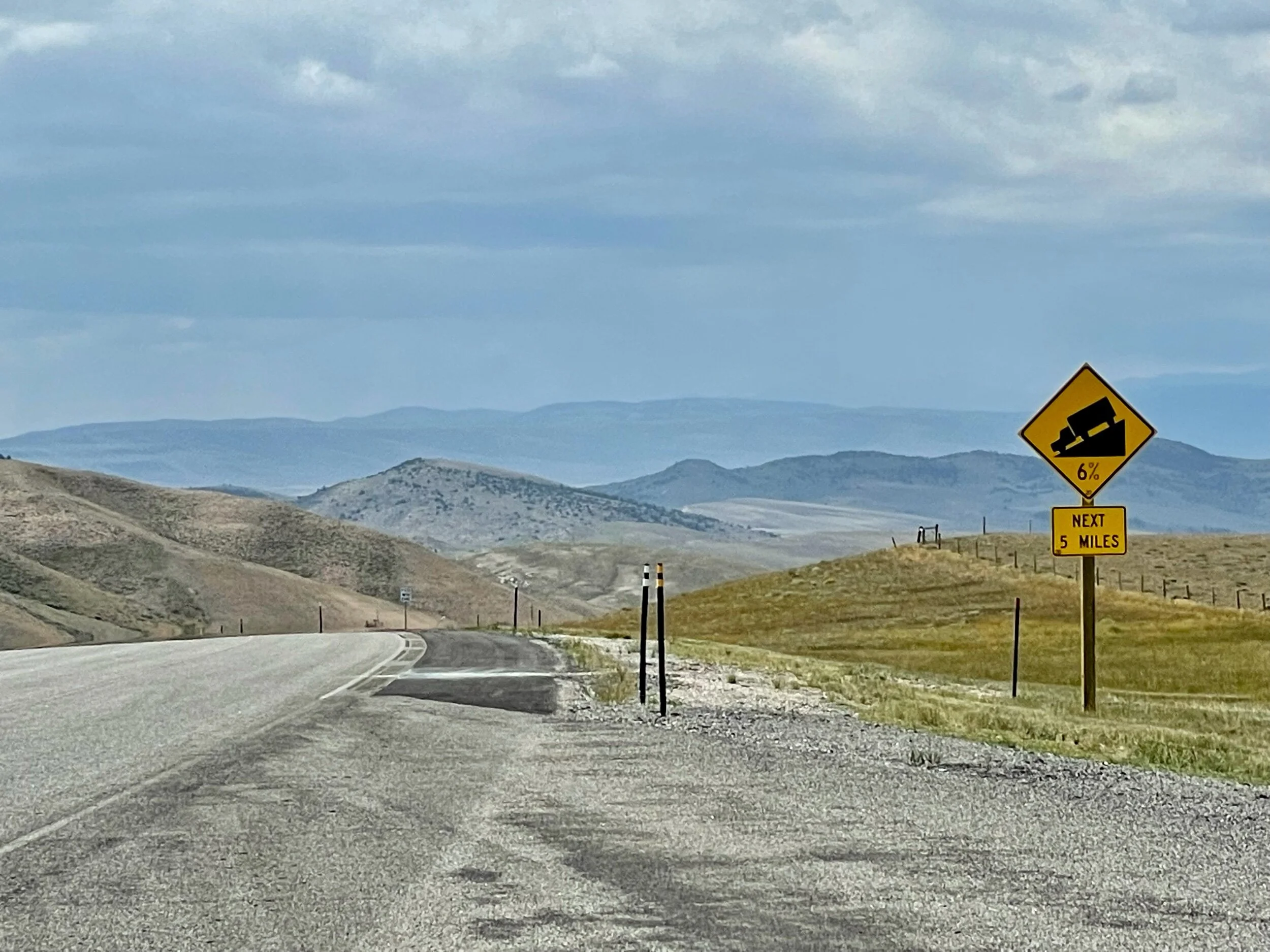
We descended over 6 miles at a grade of 6%
Any small river or creek will break apart mountains
On the bottom of the descent we are in a new micro climate where we see flowers and green again at 5,600’
Our friends on the tandem bike, Jamie & Laura join us at the RV Park in the evening for a beer and good company


![The Ice Slough - As travelers on the Oregon Trail made their way west up the Sweetwater River valley, they found the grade even, but the road was often sandy and the winding river required many crossings.Thirty miles or so before the trail left the valley to climb steeper stretches toward South Pass, emigrants forded the river yet another time, crossed a sandy, five-mile stretch and then came to a place many seem to have heard about in advance, though some doubted its existence.This was Ice Slough, better known in the 1840s, 1850s and 1860s as Ice Springs.”We were told we would come to ice spring this evening,” California-bound Thomas Eastin wrote July 14, 1849. “[W]e were told that we would find it in a low swampy place and that by digging a little below the surface we would find plenty of ice. The story appeared incredible and we paid no attention to it …”But when Eastin’s party arrived they found other travelers already camped there—and, in fact, one or two were eating ice. “They took us to the place where they got it and with a spade we dug down about 12 inches beneath the surface and there sure enough found as pure ice as I ever saw about 10 inches thick,“ he wrote.“We took up a bucket full. The story I fear will hardly be believed but it is nevertheless true.”The Ice Slough is actually a small, subsurface tributary that drains into the Sweetwater. A variety of marsh grasses and related tufted marsh plants, known as sedges, form a patchwork of surface plant life. Water flowing underneath this peat-like vegetation freezes solid in the winter and remains frozen during the spring and early summer, thanks to the insulating peat.Longtime trails historian Gregory Franzwa called the slough "one of those absolutely delightful interludes that somehow seemed to crop up just as the incessant slogging west was putting emigrants in the lowest of spirits."Ice Slough in winter, looking south from U.S. Highway 287. Randy Brown. Ice Slough today, where it drains under U.S. Highway 287 and north toward the Sweetwater at the top of the picture. Wyoming Tales and Trails. “Here we found a great curiosity,” Mormon pioneer Norton Jacob wrote June 24, 1847. “[It] would seem that Vegetation & Frost had agreed to operate in copartnership, for in digging through a grassy turf to open a Spring we found plenty of Ice!”Some travelers were prepared for a treat. “[W]e gathered several buckets full [of ice], Dr. William Thomas noted on June 16, 1849, “from which we have had mint julips in abundance.” Others could only remember past pleasures. “[W]ere it not for the absence of Brandy and mint, we might have had a beautiful Julep,” Henry Mann wrote when he passed Ice Slough two weeks later.Because the place was such a novelty, many, many diarists wrote about it. In spring and early summer, some described a layer of peaty plant life floating on a layer of heavily alkaline water, under which lay the ice—clear, sweet, thick and good tasting.“The Ice is found from 8 to 10 inches beneath the surface,” James Pritchard wrote on June 16, 1849. “There is from 4 to 6 inches of water above the Ice, and a turf or sod of grass apparently flo[at]ing on the water, upon which you can walk all over it. You can stand and Shake for 2 or 3 rods Square.” Many emigrants noted this shaking ground as they passed; some seemed to have seen similar shaking in bogs elsewhere.“The water above the Ice is pretty strongly impregnated with Alkali,” Pritchard continued. “To get to the Ice you take a spade or Ax & cut away the sod & then strike down & cut it out in Square blocks. The Ice is clear & pure entirely free from any Alkali or other unpleasant taste. It is from 4 to 10 inches thick, and as good as any I ever cut from the streams in Kentucky,” he concluded.As the summer weeks passed, emigrants described a layer between the ice and the peaty plant layer that was more and more like mud and less like clear--if alkaline--water. By late summer, many were unable to find any ice at all.Steady use of the trail over three decades by what eventually totaled hundreds of thousands of people and millions of head of livestock seems to have changed the place as well.In early July 1862, Oregon-bound Aaron Clough found a company of around 40 soldiers camped near the slough, and most likely near what had been a Pony Express station the year before until that operation was abandoned on completion of the transcontinental telegraph. The troops were probably members of the Ohio cavalry regiment that had arrived in the area a few weeks earlier to protect white travelers from raids by Indian warriors.The place seemed less charming to Clough than it had to earlier diarists. “The slough at Ice springs is a spouty, swampy place, and is a dangerous place for stock. You can shake the ground for rods around by jumping up and down. If an ox gets stuck in the slough, it is almost impossible to get him out. … The water has a bad taste, a kind of sulphury or stone coal taste, like the water in the wells down on the Platte.”Two weeks later, Randall Hewitt found the place littered with the carcasses of dead animals, killed, apparently, by the bad water. Buzzards were preying on the carrion. “It was a dirty, sandy, pestilential hole,” he wrote.And the Army’s horses and mules had eaten nearly all the grass. “This escort had so far succeeded in just about denuding the country of what little feed there was, and was always sure to locate and occupy the best spots,” Hewitt wrote.He felt tricked; it made him angry. “This delectable spot is named ‘Ice Spring’ by the guide books,” he noted. “It was said ice could be found by digging down about two feet. All traces of ice, if there had ever been any in the summer season, had disappeared before we got there. That ice story was a cold-blooded romance, put in the guide books to deceive.”](https://images.squarespace-cdn.com/content/v1/6037c8aef912d027d4368fa1/1629498272340-TR3USAYXLDWHZ3J7VM34/IMG_2907.jpeg)


