Day 72 - Thursday, August 5
Taking a day off is good and bad. The good is sleeping in’ish - instead of 3am wake up it is 6am because I still go to bed at 8pm and just can’t stay in bed that long. A relaxing coffee, breakfast is awesome and then chores. By the end of the day I’m not so tired and don’t fall asleep until later setting up a tough first day back. Yesterday was that day and my stomach was in turmoil from the day off, eating a lot and not working it off. I also developed a pain behind my right knee.
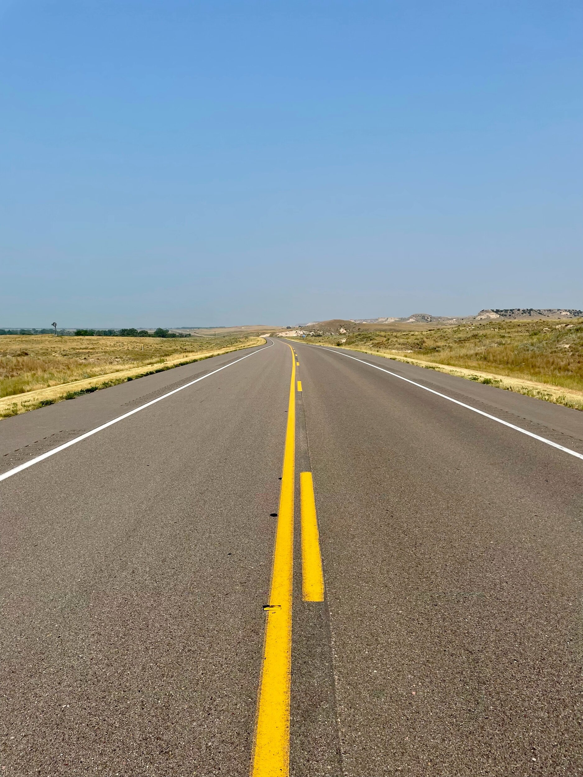
Same time I was exhausted last night from not enough sleep, getting beaten up on the road and passed out early at 7pm. Then back up at 2:50am and on the road with Lucky at 4am for what turned out to be an extraordinary day on the road. No pain in knee, could have run all day even though temps got to 96 degrees.
While Lucky’s blood panel was good, he is not eating and very sluggish. The Chef cooked him chicken breasts and he half heartedly ate 3 small pieces and crawled back up into a ball to sleep. I spoke to the Vet in Oshkosh about this and like all the others, she told me this is a quality of life decision and if he wants to run, this is why we are doing this. So at 4am as I put on my pack and hat he mustered his energy and we had a glorious morning on Route 26 running through western Nebraska.
The terrain is definitely changing - we climbed from 3,300’ to 3,600’ today and we began to see rock formations in The Sandhills of Nebraska that we think of in the movies with the limestone high plains. It is easy to see how the pioneers followed the great Platte River through this area as it is bordered by the limestone hills like a chute. Tomorrow we make it to the famous Chimney Rock that they orienteered towards as a beacon. There was a marker on the top of one of these formations:
Mormon emigrants traveling west along the north sided of the North Platte River saw many topographical features that were not visible from the south side of the river. These features served as landmarks that guided the Latter-day Saints along their route to the Utah Territory.
Thirty-one miles west of Ash Hollow a line of bluffs called Cobble Hills began to transform the landscape from sand to gravely limestone. At these bluffs on May 22, 1847, Orrin Porter Rockwell, a guide with the vanguard Mormon Pioneer Company, returned to camp stating he “…had been on the high bluff about a mile northwest and has seen a rock called Chimney Rock.”
William Clayton was concerned about the correctness of the distance on the Fremont-Pruess map that they were using as a guide. After hearing that Rockwell had glimpsed Chimney Rock, Clayton decided to see for himself. Although footsore and weary he took his telescope and climbed to the top of the highest bluff to see the famous landmark. He ascertained that at a distance of 20 miles he could see Chimney Rock very plainly with the naked eye.
Major heatwave going to be hitting us starting tomorrow with temps of 100. I will continue to launch at 4am and get the 30+ miles done by noon to avoid the damage of the late day heat.
All for today - I appreciate your support!
Cheers,
David.
Long farm roads off of Route 26
Lucky enjoying a break on Route 26
Sunrise on a hazy morning
This is incredible coffee shop in the town of Oshkosh serving Kona coffee and one of the best cinnamon buns I have ever eaten
Eat Beef!
Lucky after his morning run session getting some love from Chris
The landscape has changed in The Sandhills of NE
Massive Dead Tree 1
Massive Dead Tree 2
On this spot Narcissa Whitman, trail-blazer and martyred missionary, is one of the great heroines of the frontier West. In 1836 she and Eliza Spalding, following the north side of the Platte on horseback, became the first white women to cross the American continent. The Protestant "Oregon Mission" was composed of Dr. Marcus Whitman, Rev. Henry Spalding, their new brides, and William Gray. They traveled from New York to Otoe Indian Agency (Bellevue, Nebraska), then joined an American Fur Company caravan led by Thomas Fitzpatrick. From the Green River rendezvous they journeyed westward with traders of the Hudson's Bay Company. In November, 1847, Narcissa, her husband, and eleven others, were massacred by Cayuse Indians at their Walla Walla mission, now a National Historic Site. The missionaries passed this point in June, 1836. In May, 1847 the Mormon Pioneers passed here en route from Winter Quarters (present North Omaha) to Salt Lake Valley, calling these formations "Ancient Bluff Ruins." Beginning with the California Gold Rush in 1849 this "Mormon Pioneer Trail" became "the Council Bluffs Road" to emigrants bound for the West Coast.
Narcissa Whitman
The stories this tree could tell on the Mormon Trail…
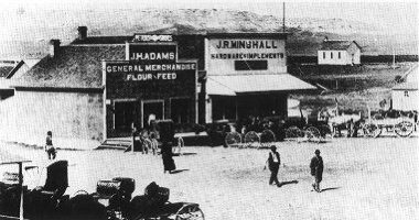
Broadwater, Nebraska, in Morrill county began April 22, 1909. The four Smith Brothers, Morton, Ed, Lloyd, and Fritz, who owned a ranch just to the east, gave some land and sold some for a town site. It was very poor land, swampy and no good for anything else.
The first building, built by Martin Wehn from back east, was an 18 x 20 foot grocery store using lumber hauled from Lisco and Bridgeport. There were many homesteaders and Kinkaiders here at that time.
Soon many friends of Wehn's came, and business and building was on the increase. The first post office was opened in 1909, while the first bank (14 x 16 foot) was built in 1911. A lumber yard was first opened in 1910 by Foster Lumber Yard Company, with the Broadwater lumber yard built in 1918, later sold to Foster and operated until 1958.
Jess Minshall came in 1909 and built a hardware store. The next year Harry Shull opened the first drug store. The first school also opened in 1910.
The first newspaper was published in 1911, subscriptions $1.50 per year. After many different owners it closed in 1958.
What started all this commotion? The railroad came through! The depot was built in 1909 and from then on houses and business sprung up and Broadwater became a thriving town.
Our first barber, Anson Bennett, had his shop from 1910 to 1948. Our second barber was A.M. Hartman, who opened in 1913 and barbered until 1963.
The Hub, a big two story building, was built in 1910. The second story was a dance hall, and the bottom floor, a furniture store. It later burned to the ground. The grand Metropolitan Hotel was built in 1914 and still stands but is not usable.
The only jeweler Broadwater ever had was Charles Rudisil, who opened in 1910. He was also an optometrist. 1912 saw two dentists here, but didn't stay long. Haver Bruner came in 1909 and his brother, Virgil, in 1911. They opened a grocery store and mercantile store which they operated many years.
The beet dump was built in 1913 and the first load of beets went out that fall. A Farmers' Elevator was built in 1916, and a second elevator in 1948. The old one was torn down in 1960.
Fred Spencer built a big two-story affair in 1916. The top floor was a dance hall, where a dance was held almost every Saturday night and other activities, too. Generally there was at least one good fight every dance, and bootlegging was quite prominent. The lower floor was a pool hall and beer parlor.
City services started with the first electric light system in 1916, a water system in 1921, gas line in 1931, and sewer disposal in 1935.
Dr. Pass came to town in 1917 and remained until he died in 1948. Dr. Gray came in 1918 and stayed until his death in 1958.
In 1917, Browning Bros. built a brick building and opened a hardware store and harness shop. That same year, the Isis Theatre was built by V.O. Bruner and Dallas Kepler. Silent movies were first and then "talkies." Many functions, plays, graduation, and such were held there.
Broadwater had two banks, Union State and Broadwater, that were located in two fine brick buildings across the street from each other. The Broadwater Bank went broke in the late 1920s and Union State sold to Bridgeport Bank in 1942.
The bridge over the North Platte River was opened in 1925. The Moynahan Hotel was torn down and W.P.A. used the material to build a community hall that is still standing.
School enrollment in 1927 was 211 -- up through 12th grade. Two fine brick buildings and a frame building were in use.
During the 1930s, Broadwater's population was about 600 and boasted of many businesses and three churches. At the present time the population is 165, and a lot of buildings are empty, with most homes occupied by senior citizens.
Broadwater still has three active churches, a school, the elevator, two cafes, a filling station, motel, library, and a beauty shop. We have lots of activities, American Legion and Legion Auxiliary, Community Hall, and Fire Hall with active volunteer firemen and ambulance service, and a new post office.
The trains still go by, but they tore the depot down in 1973. We just wave and let them get to where they're going.
Broadwater 1913
City Hall today


